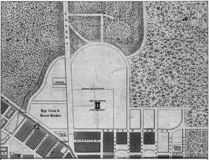
Site Plan & Aerial View: 1853 - 1880
Title
Site Plan & Aerial View: 1853 - 1880
Description
Before the Parkville site, the site proposed for the University was on Spring Street, where the Treasury Building now stands. This proposal was rejected and another proposal was made and granted for the current site in the same year, 1853.
In the initial proposal, a total of 100 acres of undeveloped land was requested in the north of the city, but only 25 acres were granted.
In the initial proposal, a total of 100 acres of undeveloped land was requested in the north of the city, but only 25 acres were granted.
Citation
“Site Plan & Aerial View: 1853 - 1880,” Constructing Change: the evolving Parkville campus , accessed February 27, 2026, https://omeka.cloud.unimelb.edu.au/constructing-change/items/show/2.
